
Point cloud precision delivered rapidly.
FastCopier
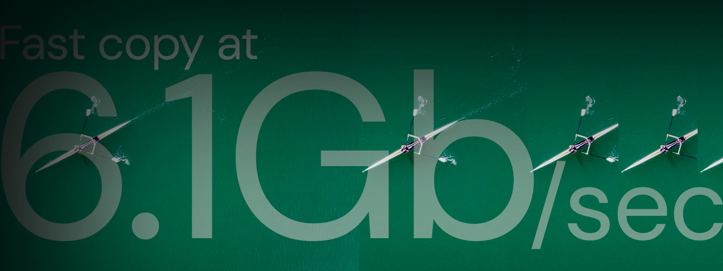
Specialised copy engines and lightning fast copying at up to 6.1Gbps.
ODB
The high-performance database offering searchability, scalability and flexibility for our Olyseus Point Cloud format.
Services
-

Software Design + Development
Our highly skilled team offers end-to-end software development from idea to implementation strategy and can design custom software solutions to meet your specialised geospatial data requirements, from both active and passive sensors.
We have the expertise and skills to effectively synchronise and fuse multi-source datasets into information rich metrics, allowing fast and efficient decision making by stakeholders.
Talk to us

-
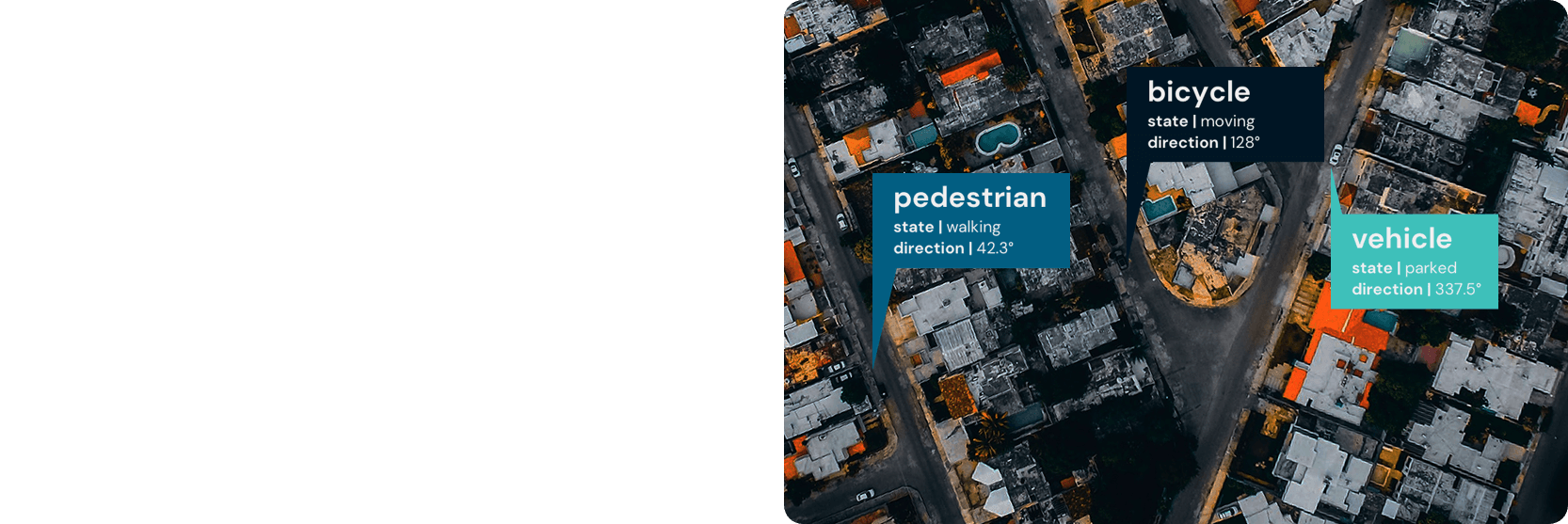
Artificial Intelligence, Machine Learning + Computer Vision
Our tailored workflows maximise the power of existing AI/ML models, making it easier and faster to extract more accurate and precise information from the complex task of automated geospatial data analysis.
We have developed a full workflow and the specialised tools necessary to deliver tailored data preparation and augmentation for training, evaluation, and inference, using cloud services such as Google Cloud and Google Cloud TPU (Tensor Processing Unit).
Talk to us
-
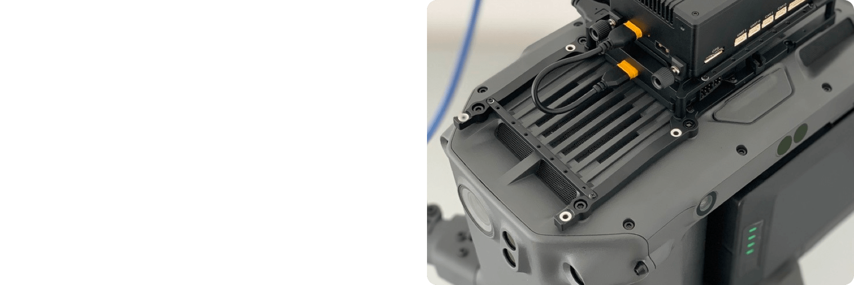
Embedded Systems + Device Programming
Our primary focus is on multi-sensors geospatial mapping systems integration and our team has years of expertise in PCB design, firmware, and embedded software development. If needed, our designs can integrate PIC32 or STM32 microcontrollers.
Our controller boards and their firmware are optimised for an efficient power management whistle, ensuring seamless integration and communication between each system’s components. Designed to enable real-time data processing, analysis, and streaming; the entire process is faster and more efficient.
Talk to us
-
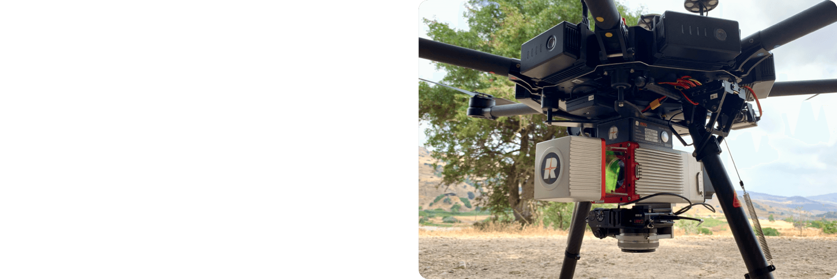
UAV LiDAR + Geospatial Data Acquisition
Our team is A1/A3 qualified, currently working on completing the A2 certification. We offer UAV LiDAR data acquisition anywhere in Cyprus and the Hellenic region.
We can deliver high quality and dense 3D point cloud LiDAR data using our RIEGL miniVUX-1 LiDAR systems and our DJI drones.
Talk to us
FastCopier
Our fast-copier is a cross-platform utility that offers high performance data copying through specialised copy engines that can access the lowest level of a storage device controller.
We clocked some copy tasks at a whopping 6.1 Gb per second data transfer rate! This is an increase of at least 15% and, on some devices, up to 50%!
Key features:
- Cross-platform utility software copying data between files and raw disk partitions
- Platform-specific copy engines to maximise read and write performance
- Managing multiple simultaneous transfer jobs
- Copy progression that survives power cycles
Applications:
Upon completion of the geospatial data collection process, there are often several Gigabytes, if not Terabytes, of data. This needs to be duplicated at least once before data processing, dissemination and archiving can begin. Our Fast Copier is an efficient tool to duplicate your data in a timely manner and error-free, and can be used by the geospatial industry, mapping system manufacturers, governments or any industry handling big data.
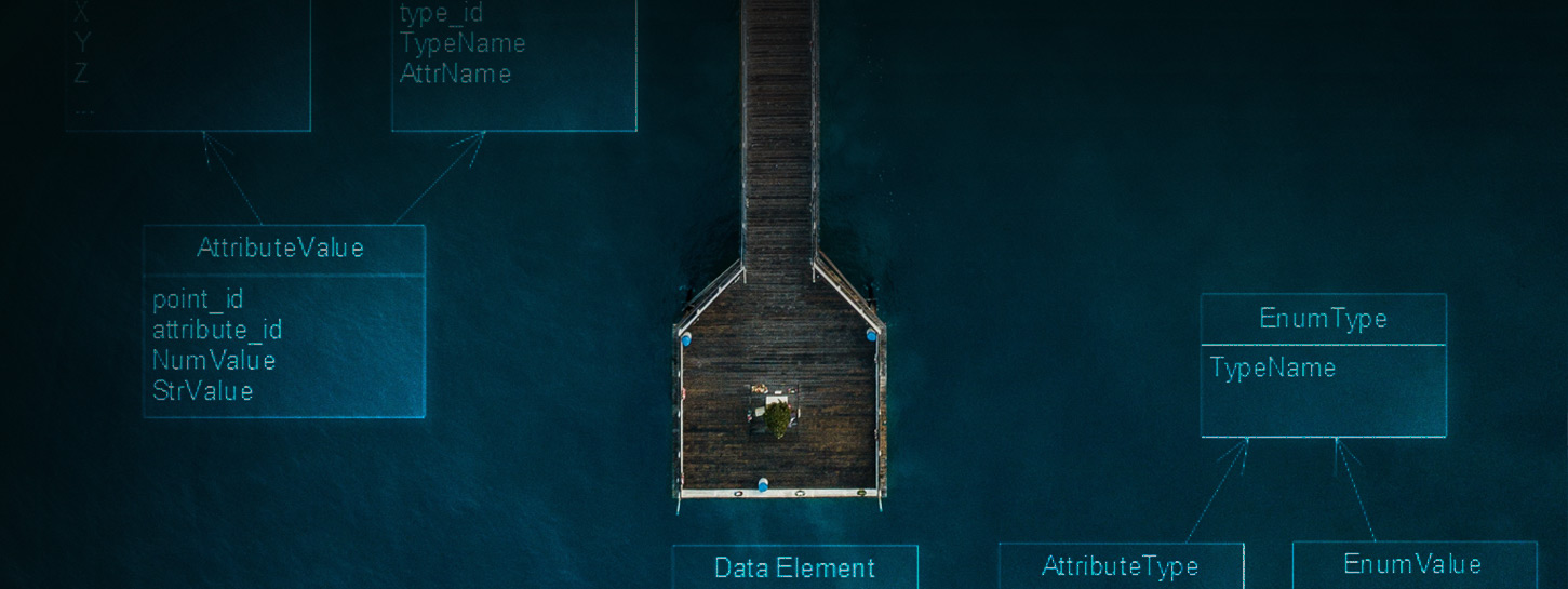
OlyPoint
OlyPoint offers a high-performance searchable point cloud file format that can support discrete returns and full-waveform data with full range and neighbours search capability. OlyPoint is tailored to handle large data sets beyond memory block limits and operating systems’ maximum file sizes.
Key features:
- Supports discrete returns and full waveform returns
- Fully searchable (range, neighbours, attributes)
- Record’s attribute is extensible
- Extensible data IO support for import and export to existing and future point cloud data format
Applications:
Geospatial applications that use point cloud are in need of speed. To answer this need, (the future Open Source) OlyPoint has been created. It offers a flexible, extensible and modern point cloud format that supports discrete and full waveform returns whistle offering a high-performance searchable and indexing capabilities.
ODB
Our Olyseus Database (ODB) is a High-Performance Database offering searchability, scalability and flexibility for our Olyseus Point Cloud format, OlyPoint. Whether you plan to use ODB with our OlyPoint file format or any other type of geospatial data (points, lines, polygons, 2D or 3D meshes or rasters), ODB will deliver the high performance needed for your use.

Key features:
- Column-oriented architecture with high compression rate, true scalability, and minimal media access
- Innovative indexing technology for speedy queries
- Designed to handle petabytes
- Modular and layered architecture. It can use ordinary files, memory, locally attached block devices, or remote block storage as its underlying medium
Applications:
Geospatial and Construction Industries